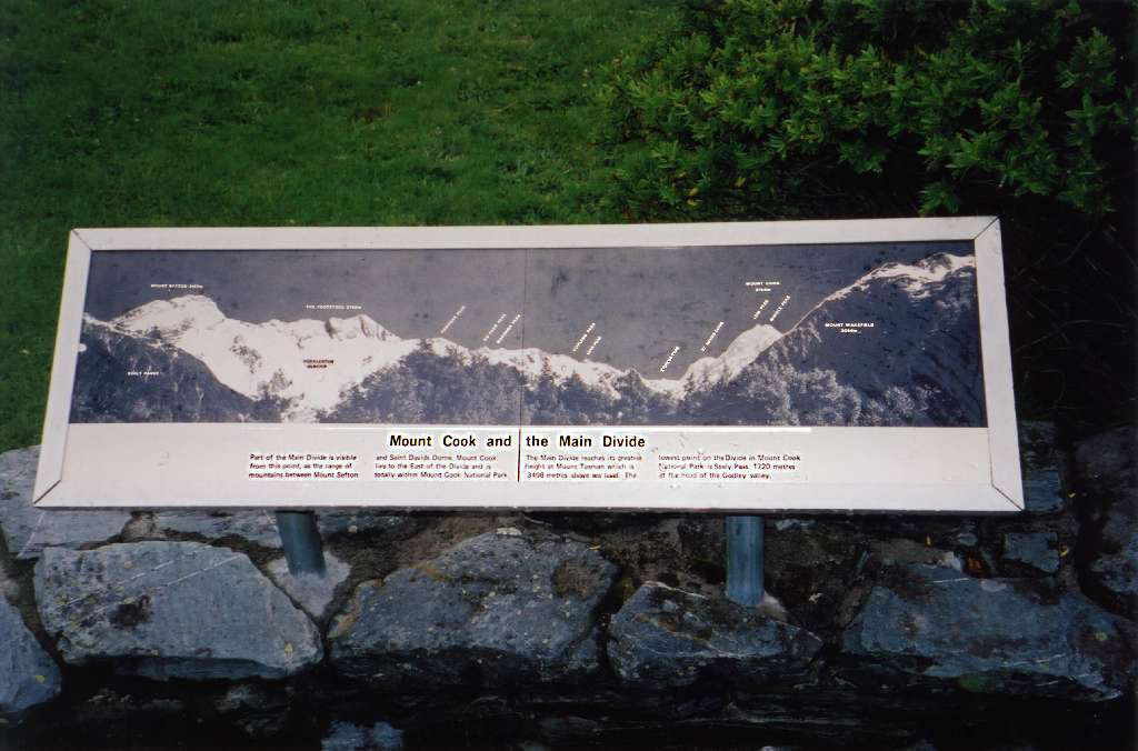
A sign at the visitors centre/Department of Conservation office Text reads: "Sealy Range", "Mount Sefton (3157 m)", "Huddleston Glacier", "The Footstool (2765 m)", "Cadogan Peak","Du Faur Peak", "Madonna Peak", "Copland Pass", "Lean Peak", "Sturdee Peak", "St Davids Dome", "Mount Cook (3754 m)", "Low Peak", "Middle Peak", "Mount Wakefield (2058m)" Mount Cook and the Main Divide Part of the Main Divide is visible from this point, as the range of Mountains between Mount Sefton and Saint Davids Dome. Mount Cook lies to the East of the Divide and is totally within Mount Cook National Park. The Main Divide reaches its greatest height at Mount Tasman which is 3498 metres above sea level. The lowest point on the Divide in Mount Cook National Park is Sealy Pass 1720 metres at the head of the Godley valley.
 |
